Tropical Storm Hermine Takes Aim at NC
Update: The NWS now projects a flash flood warning from 2 PM on Friday, September 2 to 11 AM on Saturday, September 3, 2016.
Cary, NC – Forecasts from the National Weather Service and the National Oceanic and Atmospheric Administration show the potential for dangerous weather as Tropical Storm Hermine bears down on the Southeast.
Severe Rainfall
Both the NWS and NOAA are saying, with moderate confidence, that Central North Carolina will receive between one to three inches of rainfall, which could create flash floods in localized areas. There is also a possibility for tornadoes.
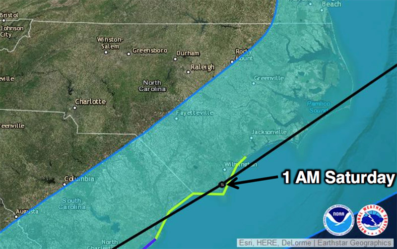
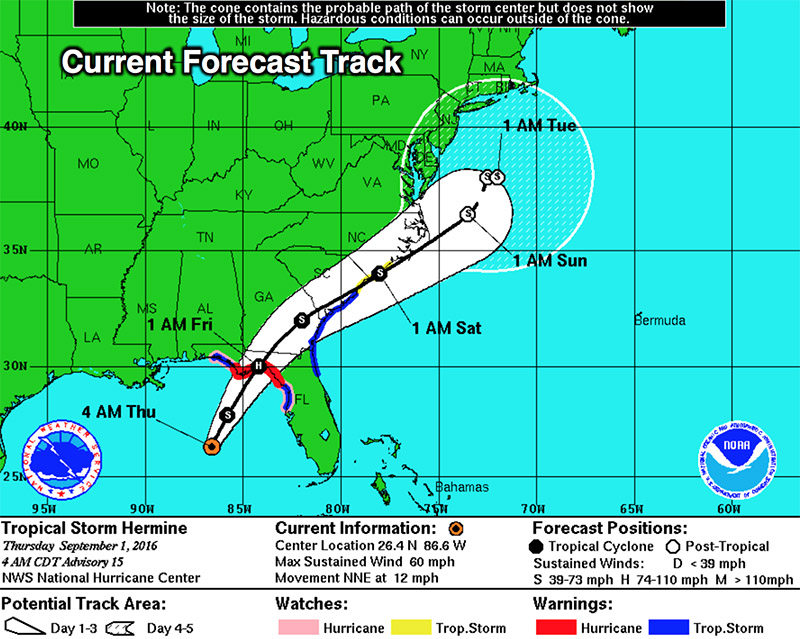
Both organizations provided this map with the current path of the hurricane.
The majority of the hurricane’s impact and rainfall is expected to hit from late Friday, September 2 night to early Saturday, September 3 evening. Threats of rain and minor flooding will continue through to Sunday, though it is a much lower risk.
Currently, models for tracking the path of Hermine have not been consistent so this information may be subject to change. The tropical storm’s path up through the Gulf of Mexico and into the Southeast United States is unusual.
This story will be updated as more critical information comes in.
Story by staff reports. Photos courtesy of the National Weather Service and the National Oceanic and Atmospheric Administration.

