
Hurricane Matthew: Forecast and Preparation
Cary, NC – With Hurricane Matthew set to bear down on North Carolina in the next few days, here is what you need to know about the forecast.
Heavy Rainfall and Winds
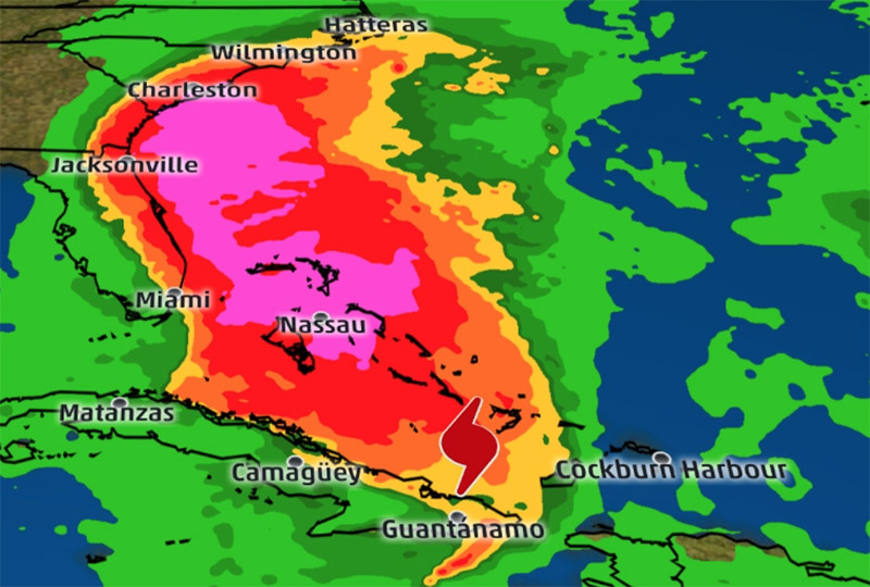
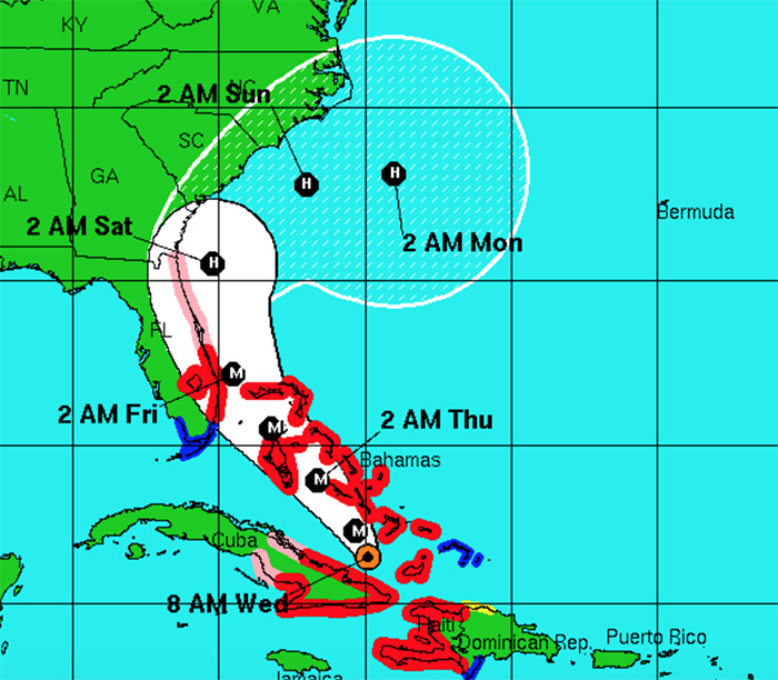
Hurricane Matthew has already caused a considerable amount of damage in the Bahamas, Haiti and other Southern islands but its force and impact should be lessened by the time it makes landfall.
The National Weather Service predicts heavy rains that may lead to flooding and gusts with enough strength to down power lines and knock over trees. The strongest flooding will likely be around North Carolina’s coasts so Cary will not feel the brunt of that bad weather but the NWS says the Southeastern part of the Triangle will be hit the most out of Central North Carolina so that includes us.
Starting Friday, October 7 evening and through Saturday, October 8, 2016, the forecast predicts one to three inches of rain and an increased risk of loss of life and property damage.
Preparation
South Carolina is already experiencing fuel shortages, so while South Carolina is set to receive more of the storm than us, it is still a good idea to fill up your car if you can.
Hurricane Matthew’s strongest periods in Cary will be from Friday evening to Saturday so plan to be ready before then and don’t schedule any time outside then if you can help it.
Remove any tree limbs, branches and other debris in your yard that could cause trouble in a windstorm. Also unblock your drains and gutters if you can. Make sure to check your water heater and other tanks as storms can stress them out and cause leaks or bursts.
And put together a basic emergency kit of flashlights, first aid, non-perishable food and water. All of that may not be necessary with this storm but it is better to be overprepared than underprepared.
Story by staff reports. Photo courtesy of the National Weather Service and Weather.com.

